Misamis Occidental
| Misamis Occidental | |||
|---|---|---|---|
| — Province — | |||
| Province of Misamis Occidental | |||
|
|||
| Nickname(s): where the color of nature is greener | |||
 |
|||
| Coordinates: | |||
| Country | |||
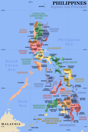
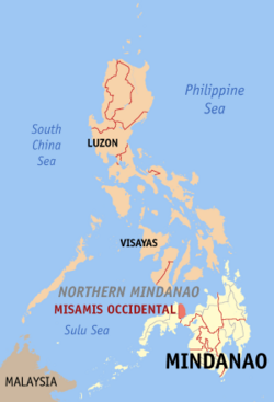
| Region | Northern Mindanao (Region X) | ||
| Founded | November 8, 1929 | ||
| Capital | Oroquieta City | ||
| Government | |||
| - Governor | Herminia M. Ramiro (Lakas Kampi CMD) | ||
| Area | |||
| - Total | 2,055.2 km2 (793.5 sq mi) | ||
| Area rank | 62nd out of 80 | ||
| Population (2007) | |||
| - Total | 531,680 | ||
| - Rank | 49th out of 80 | ||
| - Density | 258.7/km2 (670/sq mi) | ||
| - Density rank | 26th out of 80 | ||
| Divisions | |||
| - Independent cities | 0 | ||
| - Component cities | 3 | ||
| - Municipalities | 14 | ||
| - Barangays | 490 | ||
| - Districts | 1st and 2nd Districts of Misamis Occidental | ||
| Time zone | PHT (UTC+8) | ||
| ZIP Code | 7200 up to 7215 | ||
| Spoken languages | Cebuano | ||
Misamis Occidental (Filipino:Kanlurang Misamis) is a province of the Philippines located in the Northern Mindanao region. Its capital is Oroquieta City. The province borders Zamboanga del Norte and Zamboanga del Sur to the west and is separated from Lanao del Norte by Panguil Bay to the south and from Misamis Oriental by Iligan Bay to the east. The province of Misamis was originally inhabited by Subanons whose an easy target by the sea pirates from Lanao. Misamis is taken from the early settlement of the Spaniards at the entrance to the Panguil Bay.
The name "Misamis" is believed to have been derived from the Subano word "Kuyamis" which is a variety of sweeto coconut - the staple food of the early settlers in this place. During the years the name persisted as an inference of the geographical location and upon the advent of the Spanish settlers, the word "kuyamis" easily gave way to the more convenient pronounceable but corrupted word "Misamis".[1].
Contents |
History
In 1942, the Japanese Imperial forces landed in Misamis Occidental, beginning their brief occupation of the province as part of World War II. In 1945, combined American and Philippine Commonwealth forces liberated the province, and with the help of the recognized guerilla units, defeated the Japanese forces.
Geography
Political
Misamis Occidental is subdivided into 14 municipalities and 3 component cities.
Cities
- Oroquieta City
- Ozamiz City
- Tangub City
Municipalities
|
|
People and culture
The dense population along the coast consists mainly of migrants from Cebu and Bohol, thus the major dialects are Cebuano and Boholano. The native Subanons live in the interior uplands.
Economy
The province economy depends firstly on fishing, secondly on coconuts, thirdly on rice. The province has 169 kilometers of coastline fronting the rich fishing grounds of Panguil and Iligan bays. It also has the biggest area of brackish-water fishponds in the region. Tangub City is a fishing port on Panguil Bay famous for seafoods. Coconut is the chief crop. This is processed into oil, desiccated coconut, and coir, most of which are shipped to Cebu. Coconut processing is the main industry in Oroquieta City. Other crops grown are rice, corn, abaca, coffee, cacao and rubber.
Tourism and Attractions
- Binalbal Festival
- Misamis Occidental Aquamarine Park
See also
- Misamis Oriental
- Northern Mindanao, designated as Region X in the Philippines.
- Cagayan de Oro City
- Laguindingan International Airport, the first International airport in Northern Mindanao region.
References
Former Governors
José Ozámiz
Henry Regalado
Gedeon G. Quijano
External links
|
||||||||